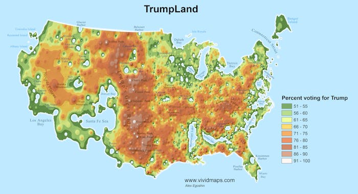
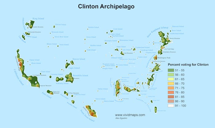
"The 2016 presidential election forced a lot of Americans to look at their country a new way, and political maps are a helpful, revealing way to do just that.
A new pair of cartograms reimagines America’s topography using data from this divisive election to literally divide the nation into two countries based on who voted for President-elect Donald Trump and who supported Hillary Clinton.
The maps were created by Alex Egoshin, a Vivid Maps contributor who says “maps are like campfires — everyone gathers around them, because they allow people to understand complex issues at a glance, and find agreement about how to help the land.”...
No comments:
Post a Comment